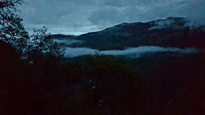
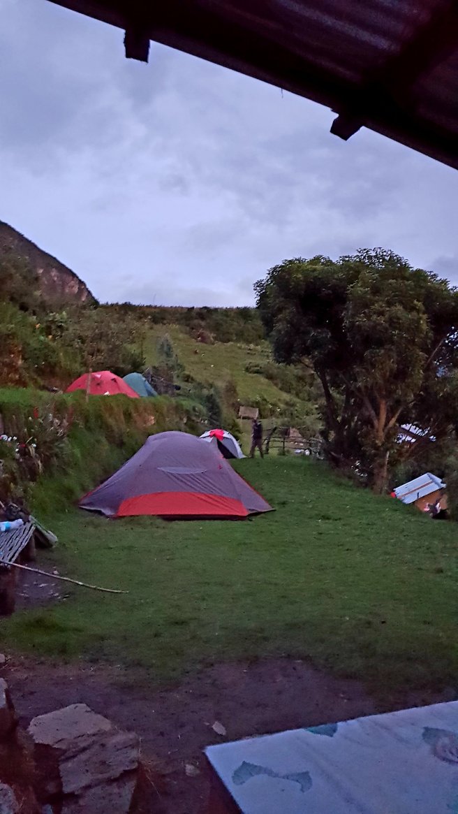
I slept ok but woke up a few times in the night. At 4am I got up as we were going to start trekking at 5am before it gets too hot. I packed up my things, ate a banana and took a couple of photos before we left the campsite. It was still pretty dark.
We started walking with our headlamps on but after around half an hour the sun came out and we didn’t need them anymore.
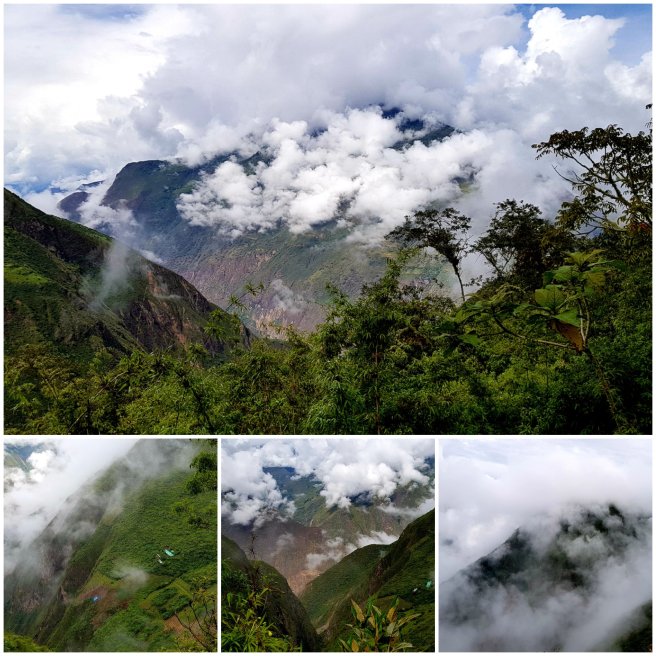
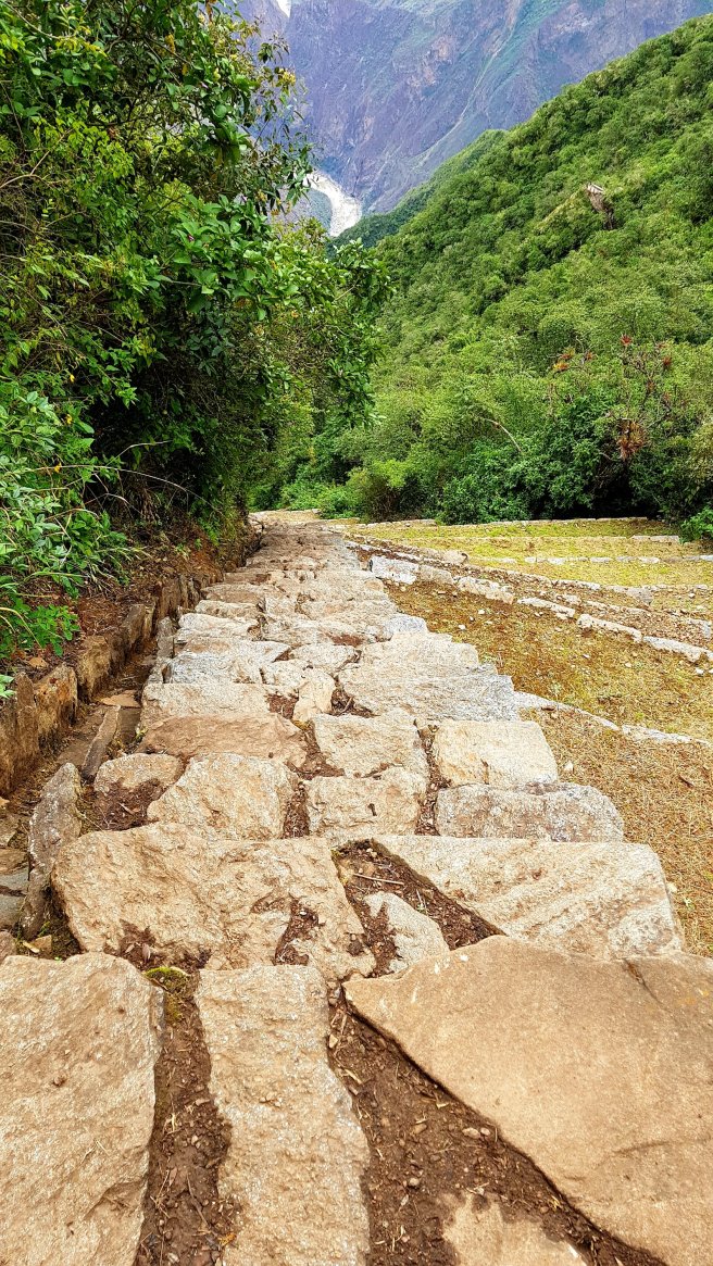
It was pretty cloudy as we were quite high up but the trek was all uphill and really steep zig zags. It was tough going.
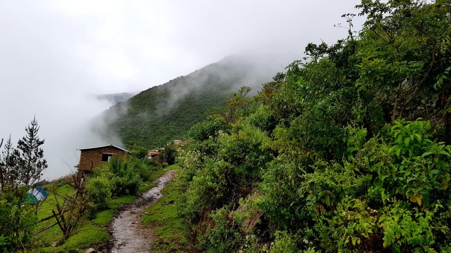
At around 730am we reached our campsite Marampata, the gatekeeper to the archaeological ruins at Choquequirao. Marampata is at 2,913m and consists of a small settlement of around 100 people.
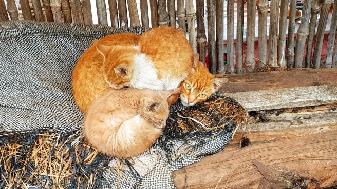
We stopped here for breakfast and I met this little family of cats, who were still pretty much asleep.
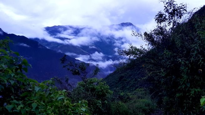
Around 9am we set off for the last leg of the trek to the site of Choquequirao. It was still quite cloudy but very warm. Again the trek was quite hard, the first bit was downhill but the second part was uphill. These are some of the views along the way.
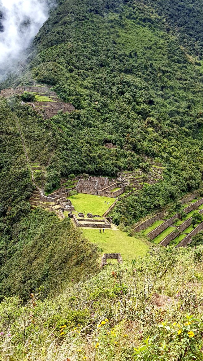
It took around 2 hours to reach Choquequirao, at just over 3,000m so we arrived around 11am. I had a little panic attack as I went to take the photo below but couldn’t find my phone, it wasn’t in my pocket where I always kept it. Luckily one of the guys behind us had found it on the floor where I must have dropped it after taking a previous photo – and he was only a couple of minutes behind us.
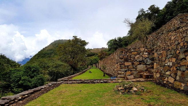
Choquequirao, meaning ‘cradle of gold’ is an amazing site to visit. There are hardly any other people around and you get loads of time to really look around and explore. These are from the main area. The large houses were most likely factories and the smaller places used for the storage of the products.

We relaxed here for a bit and then walked down to the llama wall. Llamas were sacred animals used for wool, meat, sacrifice and to transport things.
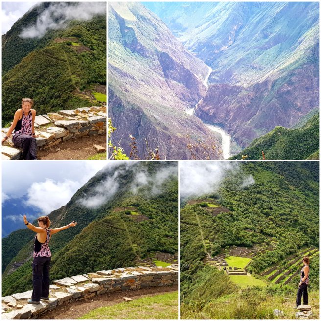
We walked across to a viewpoint and the views were pretty amazing.
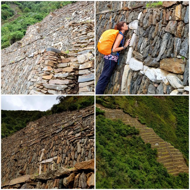
Obviously if you walk down you then have to walk up – this time we took the Inca steps. It was actually quite scary walking up the steps as they were small in width and very steep. The trick was to not look down.
The steps led up to the wall of mountains, also of significant importance to the Incas.

Once back in the main area we took a short walk up the hill to the left to take some photos.
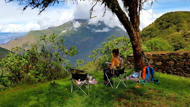
We walked back down to the main area and relaxed for a while before lunch. Eating lunch in such a historical place with the amazing views of the mountains was really special.
After lunch we walked to the Sharmen’s house. The Sharman was a very important person to the Incas and therefore he had a large and nice house with an area in the middle where rituals could be held.

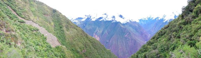
We walked up another hill to get some more photos and Edwin explained the history of the site. Choquequirao is situated in the spur of the mountain range of the Salkantay mountains. It is thought that Choquequirao was founded in 1536 and it was initially discovered in 1710 and was linked to Machu Picchu by a variety of trails. The ruins of Choquequirao are a mixture of buildings and terraces either above or below the truncated hilltop. The hilltop has been levelled and ringed with stones to create a platform 30 x 50m where ceremonies and sacrifices took place.

The top part of Choquequirao is the remains of several houses where maybe around ten families used to live.
Choquequirao is around 18km squared but only 30-40% of the ruins have currently been uncovered. The first excavations of the site began in the 1970s.
Around 4pm we headed back to the campsite at Marampata which was initially down hill but then a steep uphill towards the end. It took around an hour and a half.
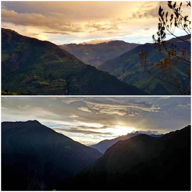
As we ate our tea and dinner the sun was setting over the mountains.
It was a really long day, we walked 22km over around 12 hours, but it was definitely worth it. I’m really pleased that I’ve seen this Inca site and also that I’ve seen it before it becomes crowded with tourists.

Absolutely stunning Heidi xx
LikeLike
It was so amazing. H xx
LikeLike